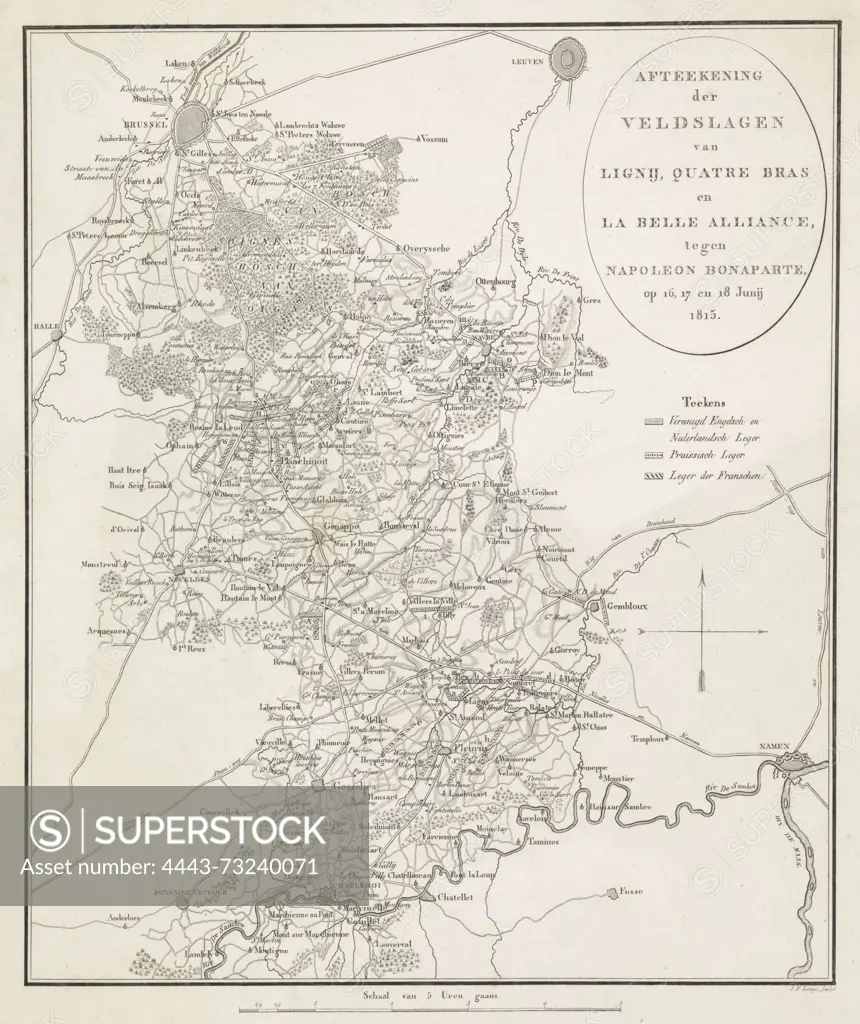
Netherlands, Lange, Johannes Fredericus, Map of the Battles of Ligny, Quatre Bras and La Belle Alliance, against Napoleon Bonaparte, on 16, 17 and 18 June 1815, Plan of the Battles of Quatre-Bras and Waterloo, 16-18 June, 1815, verso - stamped, Map of the region between Brussels and Charleroi where battles were fought between the armies of the Allies and the French army under Napoleon at Ligny, Quatre-Bras and Waterloo between 16-18 June 1815. The map shows the battle lines of the armies., print, picture, map, prints, pictures, Frederik Muller Historieplaten, height 393 mm, width 326 mm, 1770 - 1828, print maker, printmaker, 1815 - 1816, paper, papier, etching, etchings, engraving, engraving (printing process)
SuperStock offers millions of photos, videos, and stock assets to creatives around the world. This image of Netherlands, Lange, Johannes Fredericus, Map of the Battles of Ligny, Quatre Bras and La Belle Alliance, against Napoleon Bonaparte, on 16, 17 and 18 June 1815, Plan of the Battles of Quatre-Bras and Waterloo, 16-18 June, 1815, verso - stamped, Map of the region between Brussels and Charleroi where battles were fought between the armies of the Allies and the French army under Napoleon at Ligny, Quatre-Bras and Waterloo between 16-18 June 1815. The map shows the battle lines of the armies., print, picture, map, prints, pictures, Frederik Muller Historieplaten, height 393 mm, width 326 mm, 1770 - 1828, print maker, printmaker, 1815 - 1816, paper, papier, etching, etchings, engraving, engraving (printing process) by Artokoloro is available for licensing today.
Looking for a license?
Click here, and we'll help you find it! Questions? Just ask!
Click here, and we'll help you find it! Questions? Just ask!
DETAILS
Image Number: 4443-73240071Rights ManagedCredit Line:Artokoloro/SuperStockCollection:Artokoloro Model Release:NoProperty Release:NoResolution:4536×5400