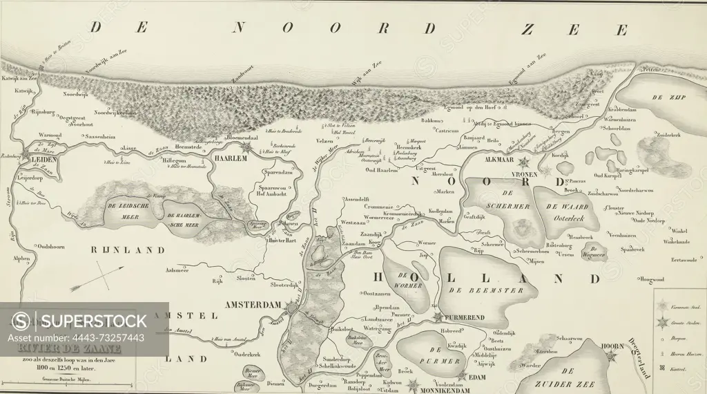
Netherlands, Illustrations or Sketch map of the river Zaane as its course was in the years 1100 and 1250 and later, Historical map showing the course of the river Zaan in the 12th and 13th century, Historical map showing the course of the river Zaan in the 12th and 13th centuries. Map oriented with the west at the top, showing the area from Leiden to Hoorn., print, picture, historical print, map, prints, pictures, Frederik Muller Historieplaten, height 288 mm, width 518 mm, print maker, printmaker, 1847 - 1849, second quarter 19th century, paper, lithography (technique)
SuperStock offers millions of photos, videos, and stock assets to creatives around the world. This image of Netherlands, Illustrations or Sketch map of the river Zaane as its course was in the years 1100 and 1250 and later, Historical map showing the course of the river Zaan in the 12th and 13th century, Historical map showing the course of the river Zaan in the 12th and 13th centuries. Map oriented with the west at the top, showing the area from Leiden to Hoorn., print, picture, historical print, map, prints, pictures, Frederik Muller Historieplaten, height 288 mm, width 518 mm, print maker, printmaker, 1847 - 1849, second quarter 19th century, paper, lithography (technique) by Artokoloro is available for licensing today.
Looking for a license?
Click here, and we'll help you find it! Questions? Just ask!
Click here, and we'll help you find it! Questions? Just ask!
DETAILS
Image Number: 4443-73257443Rights ManagedCredit Line:Artokoloro/SuperStockCollection:Artokoloro Model Release:NoProperty Release:NoResolution:5460×3044