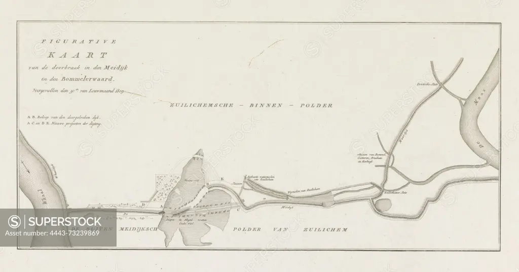
Netherlands, Figurative Map of the breach in the Meidijk in the Bommelerwaard, which occurred on the 30th of January 1809, Map of a dike breach in the Bommelerwaard, 1809, verso - stamped, Map of a breach in the Meidijk along the Waal in the Bommelerwaard in Gelderland, 30 January 1809., print, map, prints, Frederik Muller Historieplaten, height 275 mm, width 408 mm, print maker, printmaker, 1809 - 1809, paper, papier, etching, etchings, engraving, engraving (printing process)
SuperStock offers millions of photos, videos, and stock assets to creatives around the world. This image of Netherlands, Figurative Map of the breach in the Meidijk in the Bommelerwaard, which occurred on the 30th of January 1809, Map of a dike breach in the Bommelerwaard, 1809, verso - stamped, Map of a breach in the Meidijk along the Waal in the Bommelerwaard in Gelderland, 30 January 1809., print, map, prints, Frederik Muller Historieplaten, height 275 mm, width 408 mm, print maker, printmaker, 1809 - 1809, paper, papier, etching, etchings, engraving, engraving (printing process) by Artokoloro is available for licensing today.
Looking for a license?
Click here, and we'll help you find it! Questions? Just ask!
Click here, and we'll help you find it! Questions? Just ask!
DETAILS
Image Number: 4443-73239869Rights ManagedCredit Line:Artokoloro/SuperStockCollection:Artokoloro Model Release:NoProperty Release:NoResolution:6388×3348