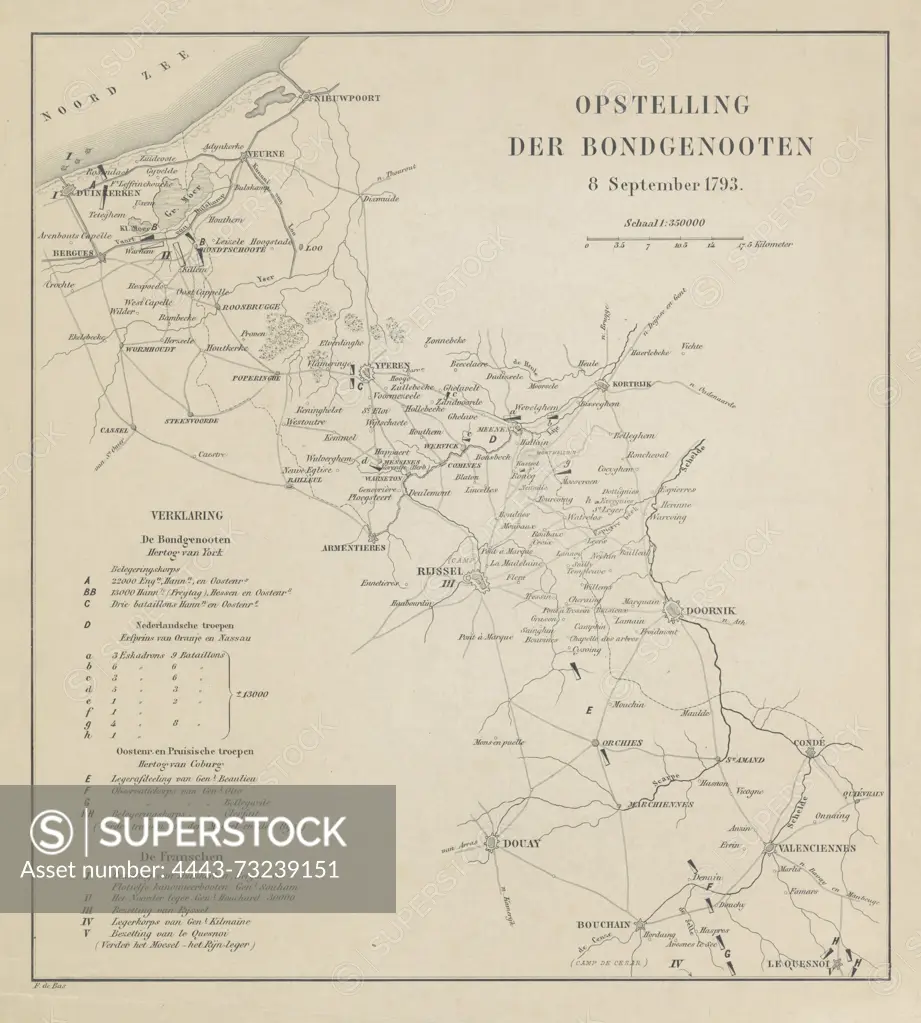
Netherlands, Bas, F. de, Opstelling der Bondgenooten 8 September 1793, Map with the positions of the allies and the French, 1793, verso - stamped, Map of the Austrian Netherlands showing the positions of the coalition troops and the French revolutionary army, 8 September 1793., print, map, prints, Frederik Muller Historical Plates, height 345 mm, width 307 mm, print maker, printmaker, 1793 - 1850, paper, papier, etching, engraving, engraving (printing process)
SuperStock offers millions of photos, videos, and stock assets to creatives around the world. This image of Netherlands, Bas, F. de, Opstelling der Bondgenooten 8 September 1793, Map with the positions of the allies and the French, 1793, verso - stamped, Map of the Austrian Netherlands showing the positions of the coalition troops and the French revolutionary army, 8 September 1793., print, map, prints, Frederik Muller Historical Plates, height 345 mm, width 307 mm, print maker, printmaker, 1793 - 1850, paper, papier, etching, engraving, engraving (printing process) by Artokoloro is available for licensing today.
Looking for a license?
Click here, and we'll help you find it! Questions? Just ask!
Click here, and we'll help you find it! Questions? Just ask!
DETAILS
Image Number: 4443-73239151Rights ManagedCredit Line:Artokoloro/SuperStockCollection:Artokoloro Model Release:NoProperty Release:NoResolution:5422×6027