Nautical chart depicting New York Harbor, created in 1874 and issued in 2007. The chart is published by the U.S. Department of Commerce, specifically the National Oceanic and Atmospheric Administration's Coast Survey. It measures 109 x 83 cm and includes colored maps illustrating navigation routes and harbors in New York and New Jersey, as well as the Hudson River
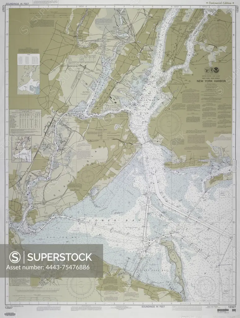
SuperStock offers millions of photos, videos, and stock assets to creatives around the world. This image of Nautical chart depicting New York Harbor, created in 1874 and issued in 2007. The chart is published by the U.S. Department of Commerce, specifically the National Oceanic and Atmospheric Administration's Coast Survey. It measures 109 x 83 cm and includes colored maps illustrating navigation routes and harbors in New York and New Jersey, as well as the Hudson River by Artokoloro is available for licensing today.
Looking for a license?
Click here, and we'll help you find it! Questions? Just ask!
Click here, and we'll help you find it! Questions? Just ask!
DETAILS
Image Number: 4443-75476886Rights ManagedCredit Line:Artokoloro/SuperStockCollection:Artokoloro Model Release:NoProperty Release:NoResolution:4314×5700