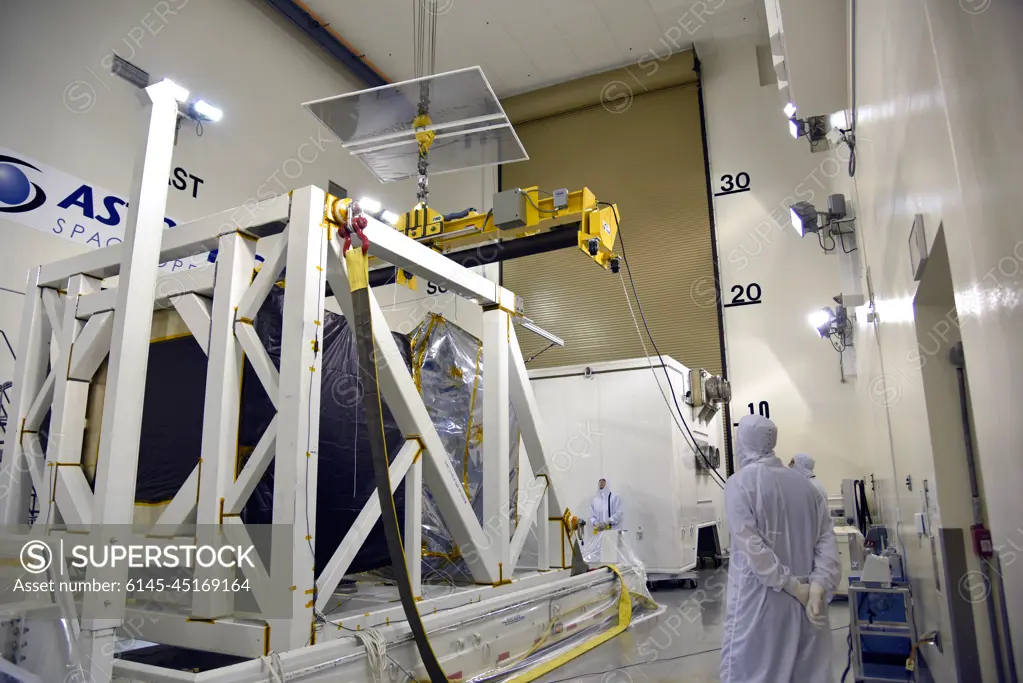
NASA's Ice, Cloud and land Elevation Satellite-2 (ICESat-2) is uncrated and is being prepared for its move to the high bay of the Astrotech processing facility on June 13, 2018, at Vandenberg Air Force Base in California. ICESat-2 was shipped from the Northrop Grumman facility in Gilbert, Arizona, where it was built and tested. The satellite is scheduled to launch from Space Launch Complex-2 at Vandenberg on the final United Launch Alliance Delta II rocket. ICESat-2 will measure the height of a changing Earth, one laser pulse at a time, 10,000 laser pulses a second. The satellite will carry the Advanced Topographic Laser Altimeter System. ICESat-2 will help scientists investigate why, and how much our planet's frozen and icy areas, called the cryosphere, is changing in a warming climate.
SuperStock offers millions of photos, videos, and stock assets to creatives around the world. This image of NASA's Ice, Cloud and land Elevation Satellite-2 (ICESat-2) is uncrated and is being prepared for its move to the high bay of the Astrotech processing facility on June 13, 2018, at Vandenberg Air Force Base in California. ICESat-2 was shipped from the Northrop Grumman facility in Gilbert, Arizona, where it was built and tested. The satellite is scheduled to launch from Space Launch Complex-2 at Vandenberg on the final United Launch Alliance Delta II rocket. ICESat-2 will measure the height of a changing Earth, one laser pulse at a time, 10,000 laser pulses a second. The satellite will carry the Advanced Topographic Laser Altimeter System. ICESat-2 will help scientists investigate why, and how much our planet's frozen and icy areas, called the cryosphere, is changing in a warming climate. by Piemags/PL Photography Limited is available for licensing today.
Looking for a license?
Click here, and we'll help you find it! Questions? Just ask!
Click here, and we'll help you find it! Questions? Just ask!
DETAILS
Image Number: 6145-45169164Royalty FreeCredit Line:Piemags/PL Photography Limited/SuperStockCollection:PL Photography Limited Contributor:Piemags Model Release:NoProperty Release:NoResolution:7360×4912