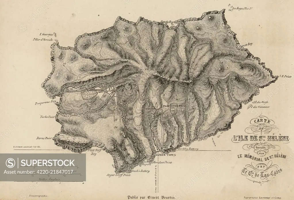
NAPOLEON I Map of the island of Saint Helena during his captivity Date: 1815 - 1821
SuperStock offers millions of photos, videos, and stock assets to creatives around the world. This image of Antique Map of Saint Helena Island: Historical Topographic Illustration by Mary Evans Picture Library/Pantheon is available for licensing today.
Looking for a license?
Click here, and we'll help you find it! Questions? Just ask!
Click here, and we'll help you find it! Questions? Just ask!
DETAILS
Image Number: 4220-21847017Rights ManagedCredit Line:Mary Evans Picture Library/Pantheon/SuperStockCollection:Mary Evans Picture Library Model Release:NoProperty Release:NoResolution:3817×2596