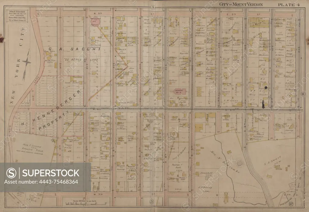
Mount Vernon, Double Page Plate No. 4 Map, bounded by W. 5th St., E. 5th St., S. 1st Ave., W. 7th St., and Mundys Lane, issued in 1899 by John F. Fairchild. The map depicts real property in Mount Vernon, N.Y., located in Westchester County, as well as surrounding areas, including Pelham
SuperStock offers millions of photos, videos, and stock assets to creatives around the world. This image of Mount Vernon, Double Page Plate No. 4 Map, bounded by W. 5th St., E. 5th St., S. 1st Ave., W. 7th St., and Mundys Lane, issued in 1899 by John F. Fairchild. The map depicts real property in Mount Vernon, N.Y., located in Westchester County, as well as surrounding areas, including Pelham by Artokoloro is available for licensing today.
Looking for a license?
Click here, and we'll help you find it! Questions? Just ask!
Click here, and we'll help you find it! Questions? Just ask!
DETAILS
Image Number: 4443-75468364Rights ManagedCredit Line:Artokoloro/SuperStockCollection:Artokoloro Model Release:NoProperty Release:NoResolution:7060×4855