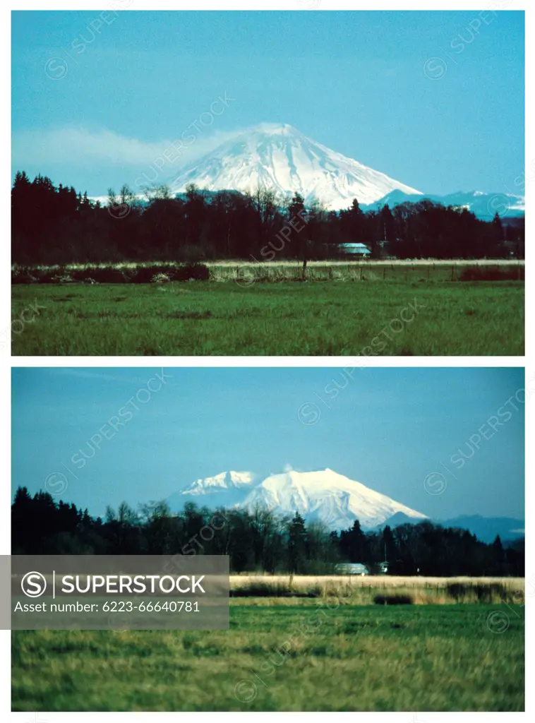
Mount St. Helens before (top) and one year after (bottom) the May 18, 1980 eruption, from south of Chehalis. The loss of the upper part of the volcano is very apparent. Photographs from April 12, 1980 (top) and February 28, 1981 (bottom). Lewis and Skamania Counties, Washington.
SuperStock offers millions of photos, videos, and stock assets to creatives around the world. This image of Mount St. Helens before (top) and one year after (bottom) the May 18, 1980 eruption, from south of Chehalis. The loss of the upper part of the volcano is very apparent. Photographs from April 12, 1980 (top) and February 28, 1981 (bottom). Lewis and Skamania Counties, Washington. by Jessica Wilson/USGS/Science Source is available for licensing today.
Looking for a license?
Click here, and we'll help you find it! Questions? Just ask!
Click here, and we'll help you find it! Questions? Just ask!
DETAILS
Image Number: 6223-66640781Rights ManagedCredit Line:Jessica Wilson/USGS/Science Source/SuperStockCollection:Science Source Contributor:Jessica Wilson/USGS Model Release:NoProperty Release:NoResolution:3606×4866