1729 Moll Map of New York, New England, and Pennsylvania (First Postal Map of New England)

1729 Moll Map of New York, New England, and Pennsylvania (First Postal Map of New England)
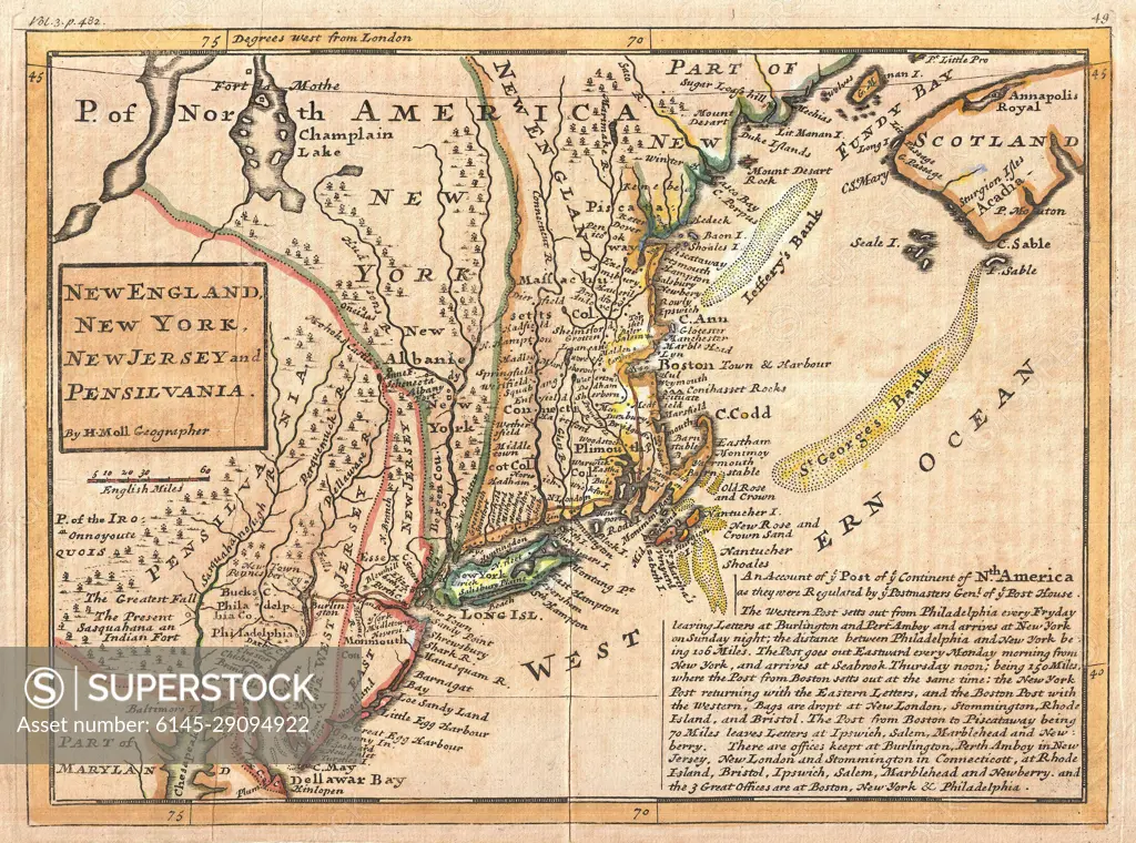
SuperStock offers millions of photos, videos, and stock assets to creatives around the world. This image of 1729 Moll Map of New York, New England, and Pennsylvania (First Postal Map of New England) by Piemags/PL Photography Limited is available for licensing today.
DETAILS
Image Number:  6145-29094922Royalty FreeCredit Line:SuperStock / Piemags/PL Photography LimitedCollection: PL Photography Limited Contributor: Piemags Model Release:NoProperty Release:NoResolution:3000×2227
Royalty Free License
Royalty-Free Standard Commercial licenses are granted for worldwide, non-exclusive and perpetual use, unless specifically noted otherwise. All Royalty-Free transactions are final. The Royalty-Free Standard Commercial license has no limitations and covers up to 15 users.
  • $50.00 Low500 X 371
  • $150.00 Med750 X 557
  • $250.00 High3000 X 2227
Free Research
Can't find the usage you need?
We're here to help!
Phone: +1 866 236 0087
Email: help@superstock.com
Research / License Request Form
Retouching Services
Our MediaMagnet division offers comprehensive retouching services at great rates. For a free quote, please send us an e-mail and we'll get back to you promptly.
Email: Retouching Service