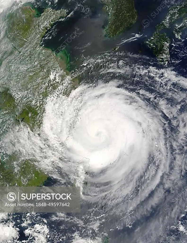
The MODIS instrument aboard NASA's Terra satellite captured this true-color image of Typhoon Rananim on August 12 at 2:40 UTC. At the time this image was taken, Rananim was located approximately 150 nm northeast of Taipei, Taiwan and had maximum sustained winds of 90 knots with higher gusts 110 knots. Rananim was moving towards the north-northwest at 13 knots
SuperStock offers millions of photos, videos, and stock assets to creatives around the world. This image of The MODIS instrument aboard NASA's Terra satellite captured this true-color image of Typhoon Rananim on August 12 at 2:40 UTC. At the time this image was taken, Rananim was located approximately 150 nm northeast of Taipei, Taiwan and had maximum sustained winds of 90 knots with higher gusts 110 knots. Rananim was moving towards the north-northwest at 13 knots by Phil Degginger/imageBROKER is available for licensing today.
Looking for a license?
Click here, and we'll help you find it! Questions? Just ask!
Click here, and we'll help you find it! Questions? Just ask!
DETAILS
Image Number: 1848-49597642Rights ManagedCredit Line:Phil Degginger/imageBROKER/SuperStockCollection:imageBROKER Contributor:Phil Degginger Model Release:NoProperty Release:NoResolution:3400×4400