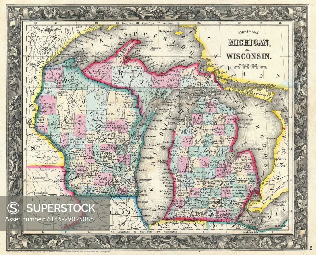
1860 Mitchell Map of Michigan and Wisconsin ( first edition )
SuperStock offers millions of photos, videos, and stock assets to creatives around the world. This image of Explore Historical Geography: Vintage Map of Michigan and Wisconsin - Discover Regional Details and Borders by Piemags/PL Photography Limited is available for licensing today.
DETAILS
Image Number: 6145-29095085Royalty FreeCredit Line:Piemags/PL Photography Limited/SuperStockCollection: