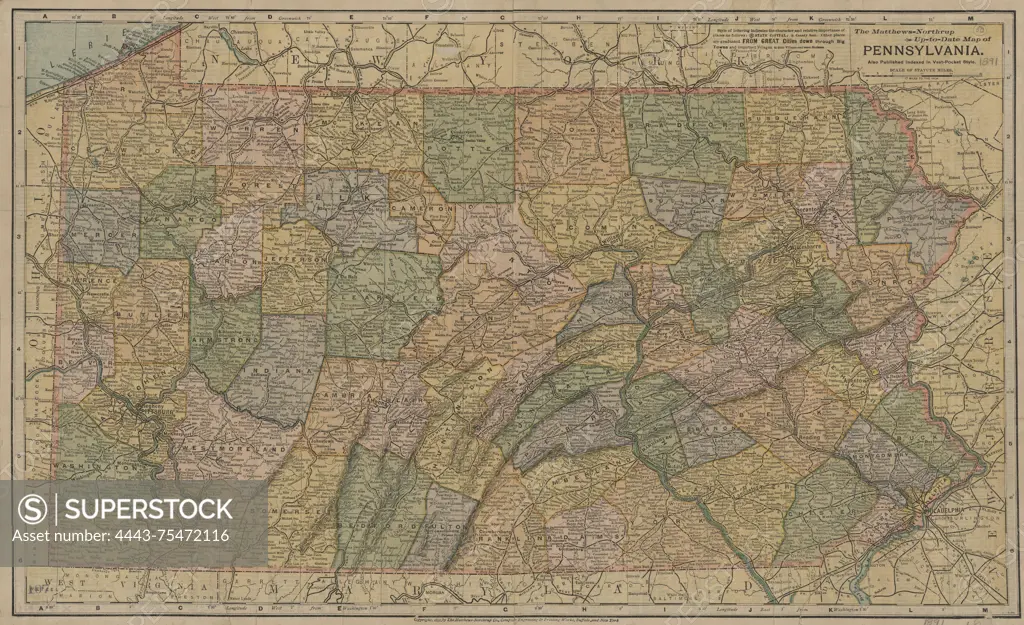
The Matthews-Northrup up-to-date map of Pennsylvania, published in 1891 by Matthews-Northrup Company in Buffalo, N.Y. This map is part of the indexed vest pocket series and depicts the administrative and political divisions of Pennsylvania. The map measures 30 x 50 cm and is folded in a cover that measures 13 x 6 cm. The New York Public Library Map Division copy lacks the cover and is filed flat. The map is mounted on cloth, which renders the index on the verso illegible
SuperStock offers millions of photos, videos, and stock assets to creatives around the world. This image of The Matthews-Northrup up-to-date map of Pennsylvania, published in 1891 by Matthews-Northrup Company in Buffalo, N.Y. This map is part of the indexed vest pocket series and depicts the administrative and political divisions of Pennsylvania. The map measures 30 x 50 cm and is folded in a cover that measures 13 x 6 cm. The New York Public Library Map Division copy lacks the cover and is filed flat. The map is mounted on cloth, which renders the index on the verso illegible by Artokoloro is available for licensing today.
Looking for a license?
Click here, and we'll help you find it! Questions? Just ask!
Click here, and we'll help you find it! Questions? Just ask!
DETAILS
Image Number: 4443-75472116Rights ManagedCredit Line:Artokoloro/SuperStockCollection:Artokoloro Model Release:NoProperty Release:NoResolution:5700×3483