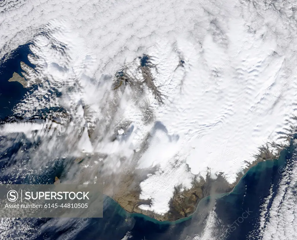
March 31, 2010The volcanic eruption near Eyjafjallajkull persists into its second week, with continued lava fountaining and lava flows spilling into nearby canyons. The eruption is located at the Fimmvrduhls Pass between the Eyjafjallajkull ice field to the west (left) and the Mrdalsjkull ice field to the east (right).This natural-color satellite image was acquired on March 26, 2010, by the MODIS aboard NASAs Terra satellite. Dark ash and scoria cover the northern half of the Fimmvrduhls Pass. White snow covers the rest of the pass, sandwiched between white glaciers. Snow-free land is tan, brown, or dark gray, devoid of vegetation in early spring.To download a high res version of this image go to:http://modis.gsfc.nasa.gov/gallery/individual.php?db_date=2010-03-31NASA Goddard Space Flight Center is home to the nation's largest organization of combined scientists, engineers and tec
SuperStock offers millions of photos, videos, and stock assets to creatives around the world. This image of March 31, 2010The volcanic eruption near Eyjafjallajkull persists into its second week, with continued lava fountaining and lava flows spilling into nearby canyons. The eruption is located at the Fimmvrduhls Pass between the Eyjafjallajkull ice field to the west (left) and the Mrdalsjkull ice field to the east (right).This natural-color satellite image was acquired on March 26, 2010, by the MODIS aboard NASAs Terra satellite. Dark ash and scoria cover the northern half of the Fimmvrduhls Pass. White snow covers the rest of the pass, sandwiched between white glaciers. Snow-free land is tan, brown, or dark gray, devoid of vegetation in early spring.To download a high res version of this image go to:http://modis.gsfc.nasa.gov/gallery/individual.php?db_date=2010-03-31NASA Goddard Space Flight Center is home to the nation's largest organization of combined scientists, engineers and tec by Piemags/PL Photography Limited is available for licensing today.
Looking for a license?
Click here, and we'll help you find it! Questions? Just ask!
Click here, and we'll help you find it! Questions? Just ask!
DETAILS
Image Number: 6145-44810505Royalty FreeCredit Line:Piemags/PL Photography Limited/SuperStockCollection:PL Photography Limited Contributor:Piemags Model Release:NoProperty Release:NoResolution:2004×1617