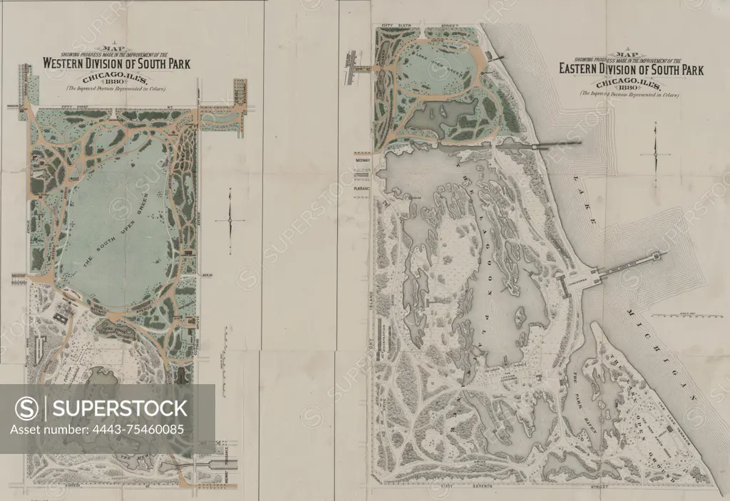
Maps showing progress made in the improvement of the Western and Eastern Divisions of South Park, Chicago, Illinois, in 1880. The improved portions are represented in colors., 1880., Chicago, Illinois., 2 colored maps on a sheet measuring 52 x 74 cm
SuperStock offers millions of photos, videos, and stock assets to creatives around the world. This image of Maps showing progress made in the improvement of the Western and Eastern Divisions of South Park, Chicago, Illinois, in 1880. The improved portions are represented in colors., 1880., Chicago, Illinois., 2 colored maps on a sheet measuring 52 x 74 cm by Artokoloro is available for licensing today.
Looking for a license?
Click here, and we'll help you find it! Questions? Just ask!
Click here, and we'll help you find it! Questions? Just ask!
DETAILS
Image Number: 4443-75460085Rights ManagedCredit Line:Artokoloro/SuperStockCollection:Artokoloro Model Release:NoProperty Release:NoResolution:5700×3917