MAPA GEOGRAFICO DEL CAMPO DE CALATRAVA, COMPREHENDE EL GOBIERNO DE ALMAGRO, LAS VARAS DE ALMADEN, ALMODOVAR DEL CAMPO, MANZANARES, DAY. Author: LOPEZ TOMAS. Location: ACADEMIA DE LA HISTORIA-COLECCION. MADRID. SPANIEN.
This asset has restrictions and cannot be purchased online. Get in touch for more details.
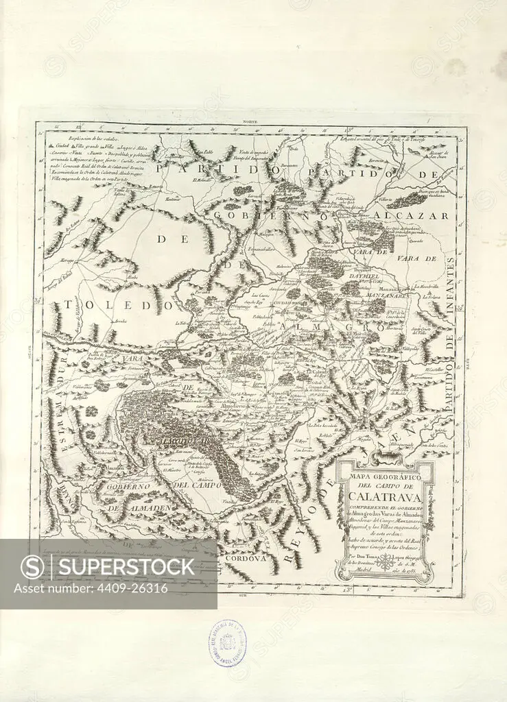
SuperStock offers millions of photos, videos, and stock assets to creatives around the world. This image of Explore Historical Spain: Vintage Map of La Mancha and Surrounding Regions – A Glimpse into the Past by Album/AFO/Album Archivo is available for licensing today.
Looking for a license?
Click here, and we'll help you find it! Questions? Just ask!
Click here, and we'll help you find it! Questions? Just ask!
DETAILS
Image Number: 4409-26316Rights ManagedCredit Line:Album/AFO/Album Archivo/SuperStockCollection:Album Archivo Contributor:Album / AFO Model Release:NoProperty Release:NoResolution:3115×4316