Mapa de España y distribución de los dos bandos contendientes durante el período de la guerra civil (1936-1939).
This image has restrictions and cannot be purchased online. Get in touch for more details.
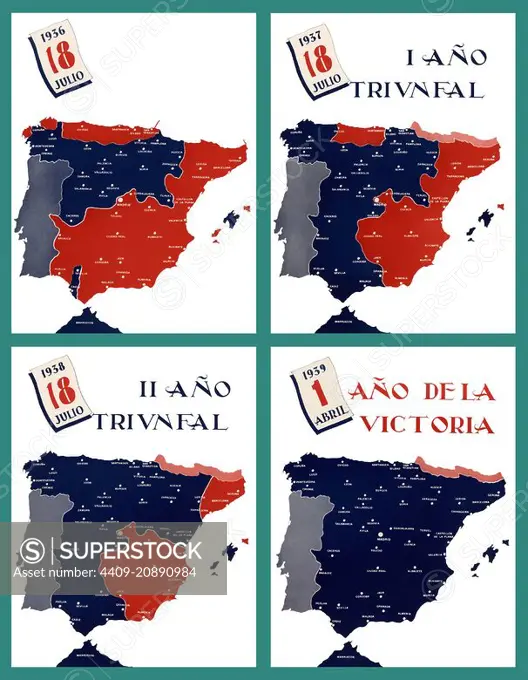
SuperStock offers millions of photos, videos, and stock assets to creatives around the world. This image of Mapa de España y distribución de los dos bandos contendientes durante el período de la guerra civil (1936-1939). by Album/Documenta/Album Archivo is available for licensing today.
DETAILS
Image Number: 4409-20890984Rights ManagedCredit Line:Album/Documenta/Album Archivo/SuperStockCollection:Album Archivo Contributor:Album / Documenta Model Release:NoProperty Release:NoResolution:4300×5533