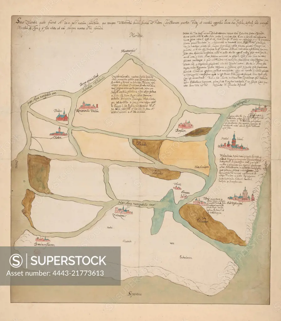
Map of Zeeland as the area would have looked around 600 and when Willibrord converted the inhabitants to Christianity. Orientation: north under., Map of Zeeland, 600 Situs Zelandiae qualis fuerat a:o IƆC post natum Christum, quo tempore Willebrodus huius incolas ad fidem christianam covertit (...), draughtsman: anonymous, 1650 - 1749, paper, pen, brush, h 576 mm × w 517 mm
SuperStock offers millions of photos, videos, and stock assets to creatives around the world. This image of Map of Zeeland as the area would have looked around 600 and when Willibrord converted the inhabitants to Christianity. Orientation: north under., Map of Zeeland, 600 Situs Zelandiae qualis fuerat a:o IƆC post natum Christum, quo tempore Willebrodus huius incolas ad fidem christianam covertit (...), draughtsman: anonymous, 1650 - 1749, paper, pen, brush, h 576 mm × w 517 mm by Artokoloro is available for licensing today.
Looking for a license?
Click here, and we'll help you find it! Questions? Just ask!
Click here, and we'll help you find it! Questions? Just ask!
DETAILS
Image Number: 4443-21773613Rights ManagedCredit Line:Artokoloro/SuperStockCollection:Artokoloro Model Release:NoProperty Release:NoResolution:4768×5448