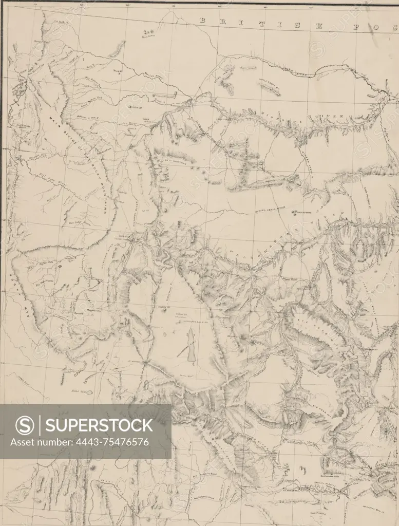
Map of the Yellowstone and Missouri Rivers and their tributaries, explored by Capt. W.F. Raynolds and 1st Lieut. H.E. Maynadier, 10th Inft. Assistant, 1859-60., 1860., Washington, D.C. Publisher, U.S. War Dept. Scientific expeditions in the Yellowstone and Missouri River Watersheds focus on geology and discoveries in geography related to the Yellowstone and Missouri Rivers in the United States., 1 map on 2 sheets, each measuring 68 x 53 cm, with overall sheet size of 81 x 60 cm or smaller
SuperStock offers millions of photos, videos, and stock assets to creatives around the world. This image of Map of the Yellowstone and Missouri Rivers and their tributaries, explored by Capt. W.F. Raynolds and 1st Lieut. H.E. Maynadier, 10th Inft. Assistant, 1859-60., 1860., Washington, D.C. Publisher, U.S. War Dept. Scientific expeditions in the Yellowstone and Missouri River Watersheds focus on geology and discoveries in geography related to the Yellowstone and Missouri Rivers in the United States., 1 map on 2 sheets, each measuring 68 x 53 cm, with overall sheet size of 81 x 60 cm or smaller by Artokoloro is available for licensing today.
Looking for a license?
Click here, and we'll help you find it! Questions? Just ask!
Click here, and we'll help you find it! Questions? Just ask!
DETAILS
Image Number: 4443-75476576Rights ManagedCredit Line:Artokoloro/SuperStockCollection:Artokoloro Model Release:NoProperty Release:NoResolution:4326×5700