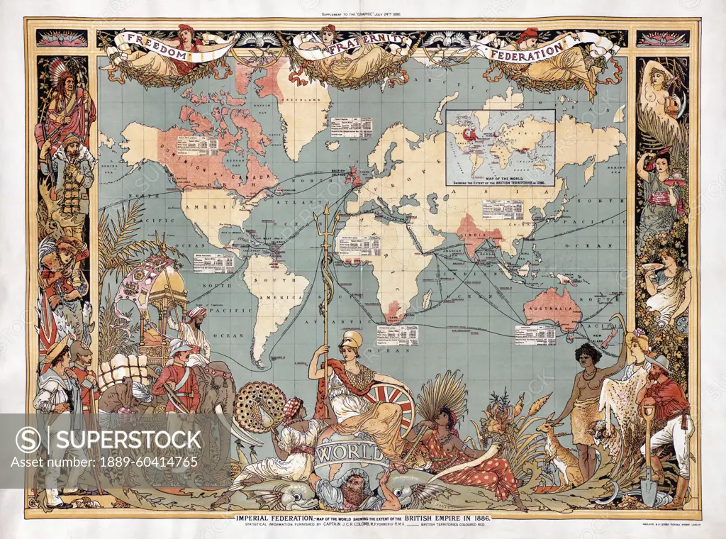
Map of the world showing the extent of the British Empire in 1886. The Empire's territories are marked in red. The map was included as a supplement in the July 24, 1886 edition of the British weekly
SuperStock offers millions of photos, videos, and stock assets to creatives around the world. This image of Map of the world showing the extent of the British Empire in 1886. The Empire's territories are marked in red. The map was included as a supplement in the July 24, 1886 edition of the British weekly by Ken Welsh/Design Pics is available for licensing today.
Looking for a license?
Click here, and we'll help you find it! Questions? Just ask!
Click here, and we'll help you find it! Questions? Just ask!
DETAILS
Image Number: 1889-60414765Rights ManagedCredit Line:Ken Welsh/Design Pics/SuperStockCollection:Design Pics Contributor:Ken Welsh Model Release:NoProperty Release:NoResolution:5906×4389