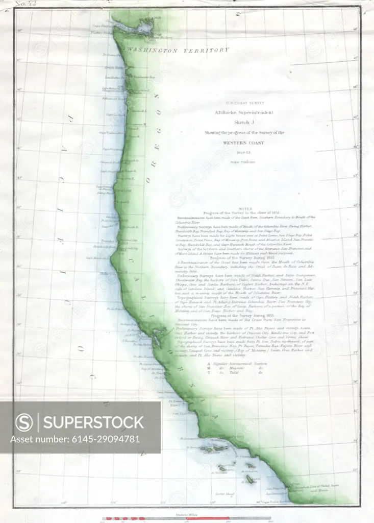
1853 U.S.C.S. Map of the Western Coast of the United States
SuperStock offers millions of photos, videos, and stock assets to creatives around the world. This image of Explore historical cartography with this detailed vintage map of the West Coast of the United States. Perfect for history enthusiasts and map collectors, this 19th-century illustration highlights the geographic features and expeditions of the era. Discover the beauty of antique maps today. by Piemags/PL Photography Limited is available for licensing today.
DETAILS
Image Number: 6145-29094781Royalty FreeCredit Line:Piemags/PL Photography Limited/SuperStockCollection: