Map of Virginia, Maryland, and the state of Delaware, issued between 1781 and 1782. Created in Brussels, the map is categorized as an early work to 1800 for Virginia, Maryland, and Delaware. The extent of the map is 1 sheet measuring 22 x 32 cm, folded to 18 x 11 cm
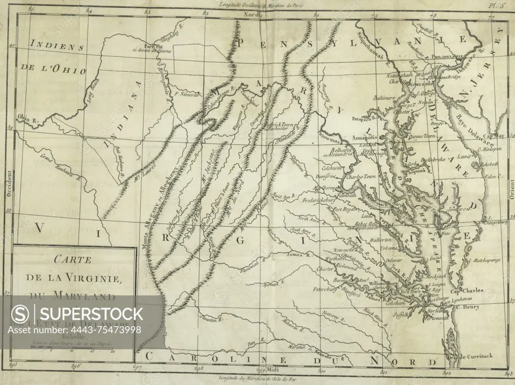
SuperStock offers millions of photos, videos, and stock assets to creatives around the world. This image of Map of Virginia, Maryland, and the state of Delaware, issued between 1781 and 1782. Created in Brussels, the map is categorized as an early work to 1800 for Virginia, Maryland, and Delaware. The extent of the map is 1 sheet measuring 22 x 32 cm, folded to 18 x 11 cm by Artokoloro is available for licensing today.
Looking for a license?
Click here, and we'll help you find it! Questions? Just ask!
Click here, and we'll help you find it! Questions? Just ask!
DETAILS
Image Number: 4443-75473998Rights ManagedCredit Line:Artokoloro/SuperStockCollection:Artokoloro Model Release:NoProperty Release:NoResolution:3173×2371