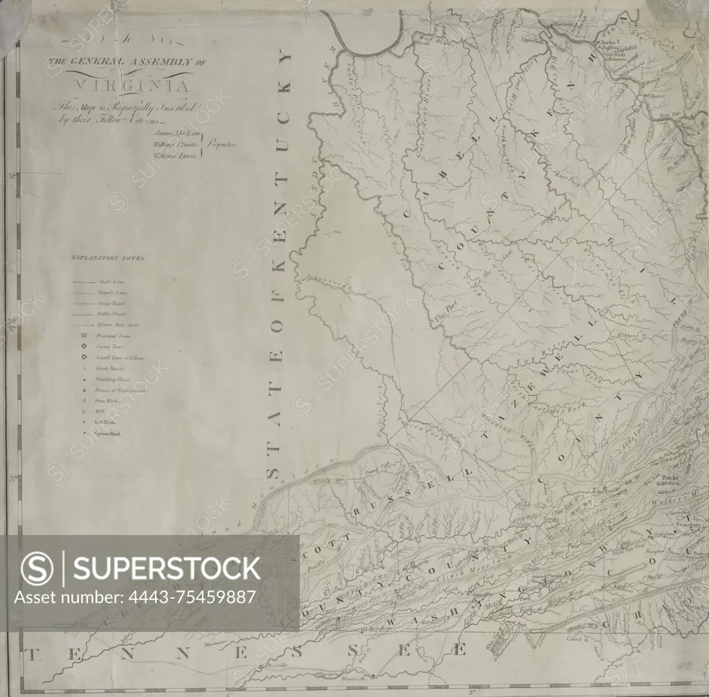
A map of Virginia, created based on actual surveys and the most accurate observations, published in 1818 by the Proprietors of the General Assembly of Virginia. The map measures 120 x 181 cm and consists of 6 sheets, each measuring 63 x 64 cm. It includes geographical details of Virginia and Ohio
SuperStock offers millions of photos, videos, and stock assets to creatives around the world. This image of A map of Virginia, created based on actual surveys and the most accurate observations, published in 1818 by the Proprietors of the General Assembly of Virginia. The map measures 120 x 181 cm and consists of 6 sheets, each measuring 63 x 64 cm. It includes geographical details of Virginia and Ohio by Artokoloro is available for licensing today.
Looking for a license?
Click here, and we'll help you find it! Questions? Just ask!
Click here, and we'll help you find it! Questions? Just ask!
DETAILS
Image Number: 4443-75459887Rights ManagedCredit Line:Artokoloro/SuperStockCollection:Artokoloro Model Release:NoProperty Release:NoResolution:4623×4549