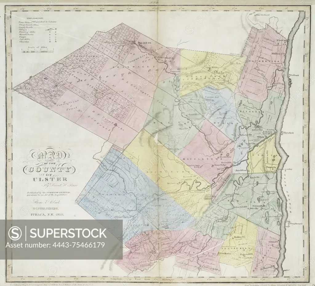
Map of Ulster County, created by Stone and Clark in 1829 and issued in 1839. The map is hand-colored and measures 42 x 46 cm. Published in Ithaca, N.Y., it details land ownership and real property in Ulster County, New York
SuperStock offers millions of photos, videos, and stock assets to creatives around the world. This image of Map of Ulster County, created by Stone and Clark in 1829 and issued in 1839. The map is hand-colored and measures 42 x 46 cm. Published in Ithaca, N.Y., it details land ownership and real property in Ulster County, New York by Artokoloro is available for licensing today.
Looking for a license?
Click here, and we'll help you find it! Questions? Just ask!
Click here, and we'll help you find it! Questions? Just ask!
DETAILS
Image Number: 4443-75466179Rights ManagedCredit Line:Artokoloro/SuperStockCollection:Artokoloro Model Release:NoProperty Release:NoResolution:3860×3506