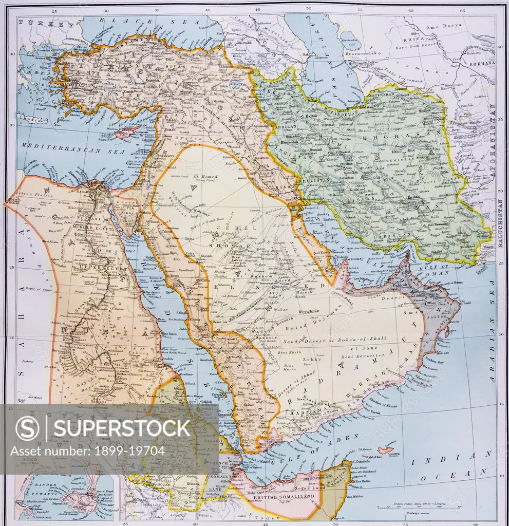
Map of Turkey Middle East Horn of Africa and Persian Gulf in 1890s From The Citizen's Atlas of the World published London circa 1899
SuperStock offers millions of photos, videos, and stock assets to creatives around the world. This image of Map of Turkey Middle East Horn of Africa and Persian Gulf in 1890s From The Citizen's Atlas of the World published London circa 1899 by Universal Images is available for licensing today.
Looking for a license?
Click here, and we'll help you find it! Questions? Just ask!
Click here, and we'll help you find it! Questions? Just ask!
DETAILS
Image Number: 1899-19704Rights ManagedCredit Line:Universal Images/SuperStockCollection: