A map titled 'Ticonderoga and its dependencies, August, 1776,' issued in 1841. It depicts Fort Ticonderoga and its surrounding areas in New York State, highlighting fortifications relevant to the historical context of the American Revolution (1775-1783). The map measures 23 x 29 cm and features a watermark by J. Whatman. The publisher is not identified
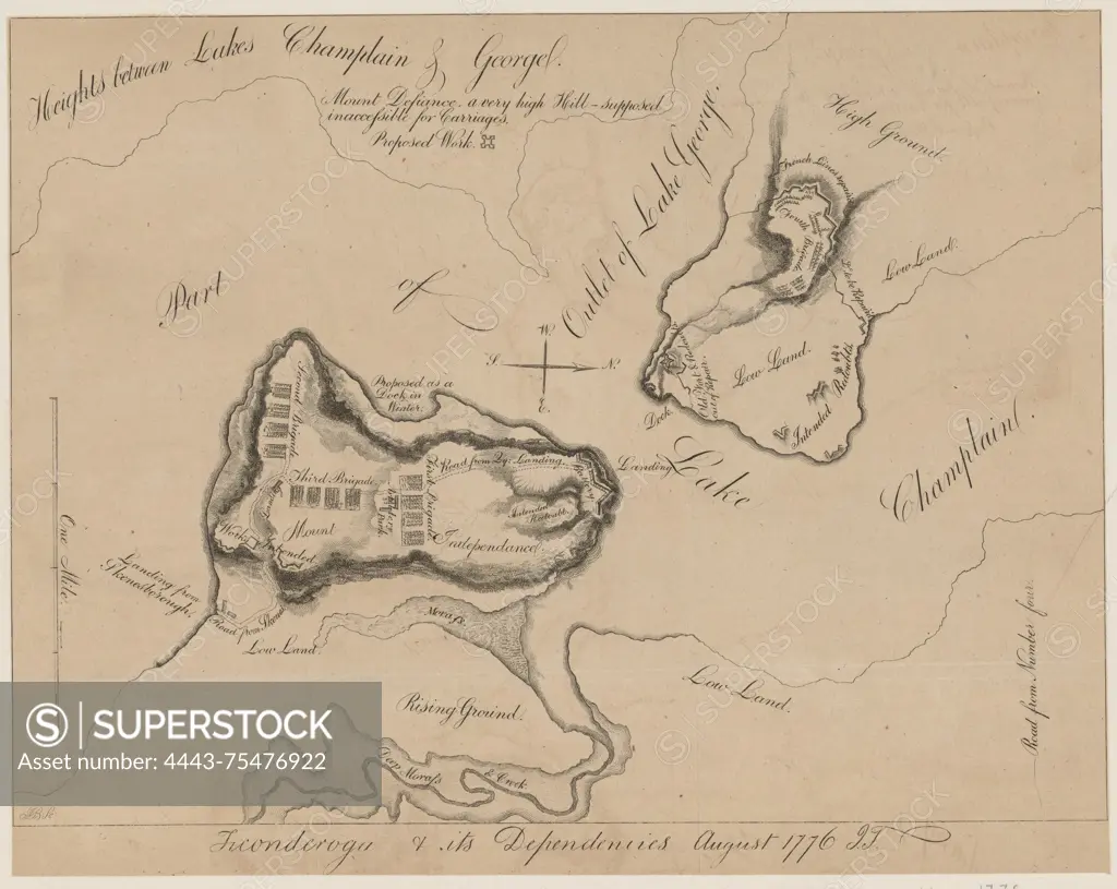
SuperStock offers millions of photos, videos, and stock assets to creatives around the world. This image of A map titled 'Ticonderoga and its dependencies, August, 1776,' issued in 1841. It depicts Fort Ticonderoga and its surrounding areas in New York State, highlighting fortifications relevant to the historical context of the American Revolution (1775-1783). The map measures 23 x 29 cm and features a watermark by J. Whatman. The publisher is not identified by Artokoloro is available for licensing today.
Looking for a license?
Click here, and we'll help you find it! Questions? Just ask!
Click here, and we'll help you find it! Questions? Just ask!
DETAILS
Image Number: 4443-75476922Rights ManagedCredit Line:Artokoloro/SuperStockCollection:Artokoloro Model Release:NoProperty Release:NoResolution:6394×5090