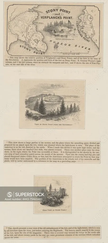
A map titled 'Stony Point and Verplanck's Point,' published by Harper & Brothers in 1859. The map highlights the historical sites related to the American Revolution (1775-1783) in Westchester County, New York. The dimensions of the map are 7 x 12 cm, and it is pasted onto a larger sheet measuring 39 x 27 cm
SuperStock offers millions of photos, videos, and stock assets to creatives around the world. This image of A map titled 'Stony Point and Verplanck's Point,' published by Harper & Brothers in 1859. The map highlights the historical sites related to the American Revolution (1775-1783) in Westchester County, New York. The dimensions of the map are 7 x 12 cm, and it is pasted onto a larger sheet measuring 39 x 27 cm by Artokoloro is available for licensing today.
Looking for a license?
Click here, and we'll help you find it! Questions? Just ask!
Click here, and we'll help you find it! Questions? Just ask!
DETAILS
Image Number: 4443-75461483Rights ManagedCredit Line:Artokoloro/SuperStockCollection:Artokoloro Model Release:NoProperty Release:NoResolution:3060×6868