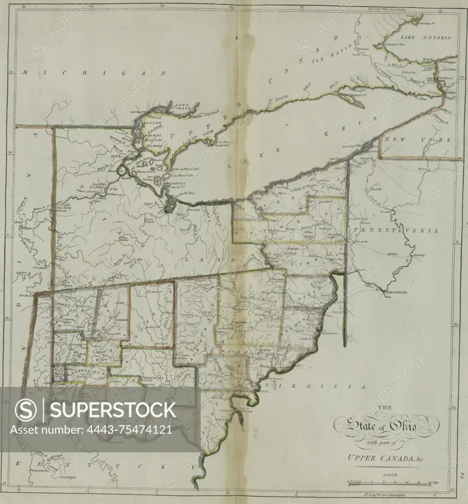
A map titled 'The State of Ohio, with part of Upper Canada, &c.,' created by Mathew Carey in 1814. Published in Philadelphia by M. Carey
SuperStock offers millions of photos, videos, and stock assets to creatives around the world. This image of A map titled 'The State of Ohio, with part of Upper Canada, &c.,' created by Mathew Carey in 1814. Published in Philadelphia by M. Carey by Artokoloro is available for licensing today.
Looking for a license?
Click here, and we'll help you find it! Questions? Just ask!
Click here, and we'll help you find it! Questions? Just ask!
DETAILS
Image Number: 4443-75474121Rights ManagedCredit Line:Artokoloro/SuperStockCollection:Artokoloro Model Release:NoProperty Release:NoResolution:3947×4248