A map titled 'Sections of the Colorado Desert,' explored by Lieut. R.S. Williamson in 1853. Issued by the U.S. War Department and the Office of Pacific Rail Road Surveys, the map features geological and survey details of California, specifically related to the Colorado Desert. The map is composed of three sections on one sheet, measuring 10 x 70 cm or smaller, presented on a larger sheet measuring 28 x 74 cm
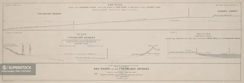
SuperStock offers millions of photos, videos, and stock assets to creatives around the world. This image of A map titled 'Sections of the Colorado Desert,' explored by Lieut. R.S. Williamson in 1853. Issued by the U.S. War Department and the Office of Pacific Rail Road Surveys, the map features geological and survey details of California, specifically related to the Colorado Desert. The map is composed of three sections on one sheet, measuring 10 x 70 cm or smaller, presented on a larger sheet measuring 28 x 74 cm by Artokoloro is available for licensing today.
Looking for a license?
Click here, and we'll help you find it! Questions? Just ask!
Click here, and we'll help you find it! Questions? Just ask!
DETAILS
Image Number: 4443-75470868Rights ManagedCredit Line:Artokoloro/SuperStockCollection:Artokoloro Model Release:NoProperty Release:NoResolution:9886×3398