A map titled 'The Principal Parts of Norwalk, in the Year 1847,' created in 1865. It features a plan of the ancient settlement of Norwalk, Connecticut. The map's dimensions are 44 x 25 cm. Several publishers are noted, including A. Selleck and Ivison, Phinney, Blakeman & Co., with lithography by Jones & Newman. It depicts landowners and real property in the Norwalk area
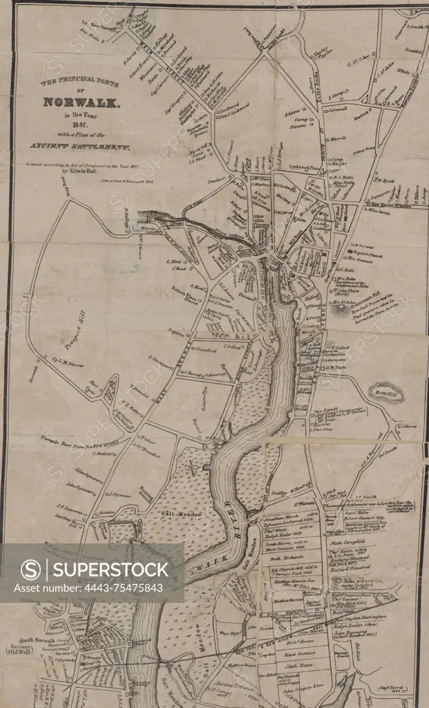
SuperStock offers millions of photos, videos, and stock assets to creatives around the world. This image of A map titled 'The Principal Parts of Norwalk, in the Year 1847,' created in 1865. It features a plan of the ancient settlement of Norwalk, Connecticut. The map's dimensions are 44 x 25 cm. Several publishers are noted, including A. Selleck and Ivison, Phinney, Blakeman & Co., with lithography by Jones & Newman. It depicts landowners and real property in the Norwalk area by Artokoloro is available for licensing today.
Looking for a license?
Click here, and we'll help you find it! Questions? Just ask!
Click here, and we'll help you find it! Questions? Just ask!
DETAILS
Image Number: 4443-75475843Rights ManagedCredit Line:Artokoloro/SuperStockCollection:Artokoloro Model Release:NoProperty Release:NoResolution:3458×5700