A map titled 'Pestilence,' created in 1889 by the Department of the Interior, General Land Office. The map, measuring 70 x 89 cm on a sheet of 79 x 98 cm, depicts the state of Oregon, including its administrative and political divisions, along with Indian reservations. It is presented in color and mounted on cloth backing. The place of issuance is Washington, D.C
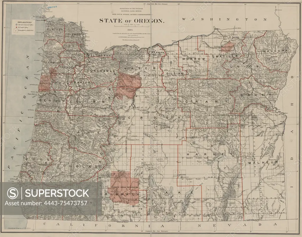
SuperStock offers millions of photos, videos, and stock assets to creatives around the world. This image of A map titled 'Pestilence,' created in 1889 by the Department of the Interior, General Land Office. The map, measuring 70 x 89 cm on a sheet of 79 x 98 cm, depicts the state of Oregon, including its administrative and political divisions, along with Indian reservations. It is presented in color and mounted on cloth backing. The place of issuance is Washington, D.C by Artokoloro is available for licensing today.
Looking for a license?
Click here, and we'll help you find it! Questions? Just ask!
Click here, and we'll help you find it! Questions? Just ask!
DETAILS
Image Number: 4443-75473757Rights ManagedCredit Line:Artokoloro/SuperStockCollection:Artokoloro Model Release:NoProperty Release:NoResolution:5700×4487