Map titled 'Nova Belgica et Anglia Nova,' created by Joan Blaeu in 1635. Published in Amsterdam by G. et I. Blaeu, the map features hand coloring and measures 37 x 49 cm. It depicts the Middle Atlantic States and New England, categorized as an early work to 1800
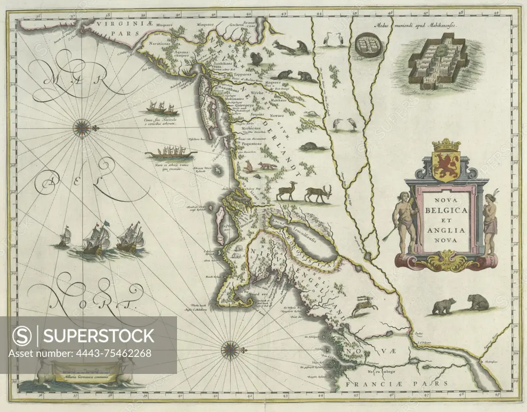
SuperStock offers millions of photos, videos, and stock assets to creatives around the world. This image of Map titled 'Nova Belgica et Anglia Nova,' created by Joan Blaeu in 1635. Published in Amsterdam by G. et I. Blaeu, the map features hand coloring and measures 37 x 49 cm. It depicts the Middle Atlantic States and New England, categorized as an early work to 1800 by Artokoloro is available for licensing today.
Looking for a license?
Click here, and we'll help you find it! Questions? Just ask!
Click here, and we'll help you find it! Questions? Just ask!
DETAILS
Image Number: 4443-75462268Rights ManagedCredit Line:Artokoloro/SuperStockCollection:Artokoloro Model Release:NoProperty Release:NoResolution:3967×3104