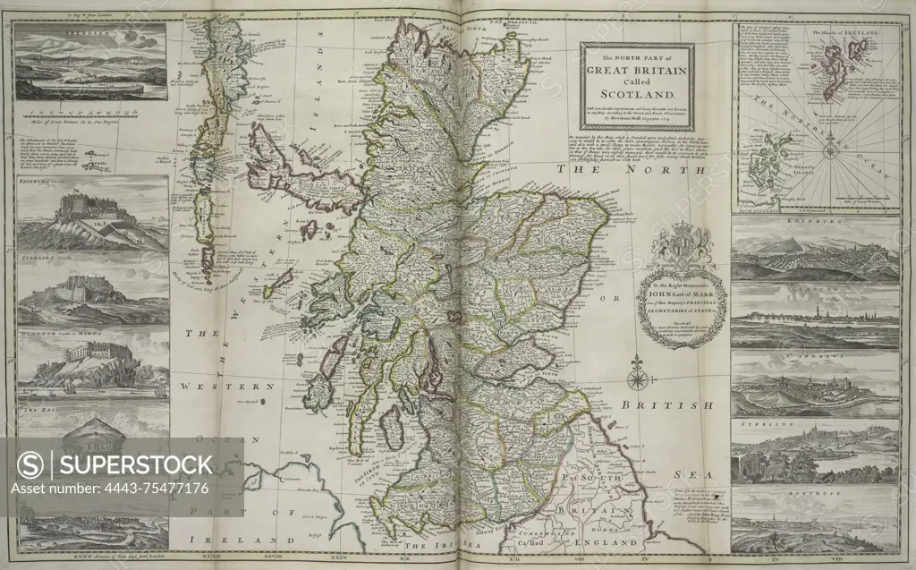
A map titled 'The north part of Great Britain called Scotland,' issued in 1736. The map is hand-colored and measures 64 x 99 cm, folded to 64 x 28 cm. It was published in London by Tho. Bowles, who was a print and map-seller in St. Paul's Churchyard
SuperStock offers millions of photos, videos, and stock assets to creatives around the world. This image of A map titled 'The north part of Great Britain called Scotland,' issued in 1736. The map is hand-colored and measures 64 x 99 cm, folded to 64 x 28 cm. It was published in London by Tho. Bowles, who was a print and map-seller in St. Paul's Churchyard by Artokoloro is available for licensing today.
Looking for a license?
Click here, and we'll help you find it! Questions? Just ask!
Click here, and we'll help you find it! Questions? Just ask!
DETAILS
Image Number: 4443-75477176Rights ManagedCredit Line:Artokoloro/SuperStockCollection:Artokoloro Model Release:NoProperty Release:NoResolution:6901×4293