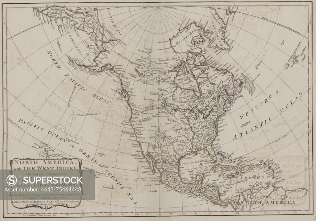
The map titled 'North America, with the West Indies' distinguishes the United States and various possessions of European powers, highlighting the latest discoveries by the English and Spaniards. It was created by Robert Sayer (1725-1794) and was issued in London in 1788, published by Robert Sayer at No. 53 Fleet-Street. This is the second edition, featuring additions, corrections, and significant improvements. The work is part of atlases from British geography, specifically early works up to 1800
SuperStock offers millions of photos, videos, and stock assets to creatives around the world. This image of The map titled 'North America, with the West Indies' distinguishes the United States and various possessions of European powers, highlighting the latest discoveries by the English and Spaniards. It was created by Robert Sayer (1725-1794) and was issued in London in 1788, published by Robert Sayer at No. 53 Fleet-Street. This is the second edition, featuring additions, corrections, and significant improvements. The work is part of atlases from British geography, specifically early works up to 1800 by Artokoloro is available for licensing today.
Looking for a license?
Click here, and we'll help you find it! Questions? Just ask!
Click here, and we'll help you find it! Questions? Just ask!
DETAILS
Image Number: 4443-75464443Rights ManagedCredit Line:Artokoloro/SuperStockCollection:Artokoloro Model Release:NoProperty Release:NoResolution:6440×4512