Map titled 'La Pologne,' Plate 19, published in 1792 by R. et J. Ottens. The map depicts Poland divided into the Kingdom of Poland and the associated states, including regions under Prussian, Austrian, and Russian control. It covers areas in present-day Poland, Lithuania, Belarus, Ukraine, and other parts of Eastern Europe. The place of publication is Amsterdam
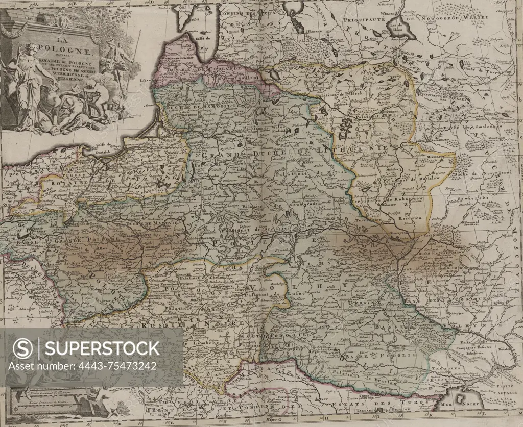
SuperStock offers millions of photos, videos, and stock assets to creatives around the world. This image of Map titled 'La Pologne,' Plate 19, published in 1792 by R. et J. Ottens. The map depicts Poland divided into the Kingdom of Poland and the associated states, including regions under Prussian, Austrian, and Russian control. It covers areas in present-day Poland, Lithuania, Belarus, Ukraine, and other parts of Eastern Europe. The place of publication is Amsterdam by Artokoloro is available for licensing today.
Looking for a license?
Click here, and we'll help you find it! Questions? Just ask!
Click here, and we'll help you find it! Questions? Just ask!
DETAILS
Image Number: 4443-75473242Rights ManagedCredit Line:Artokoloro/SuperStockCollection:Artokoloro Model Release:NoProperty Release:NoResolution:5700×4663