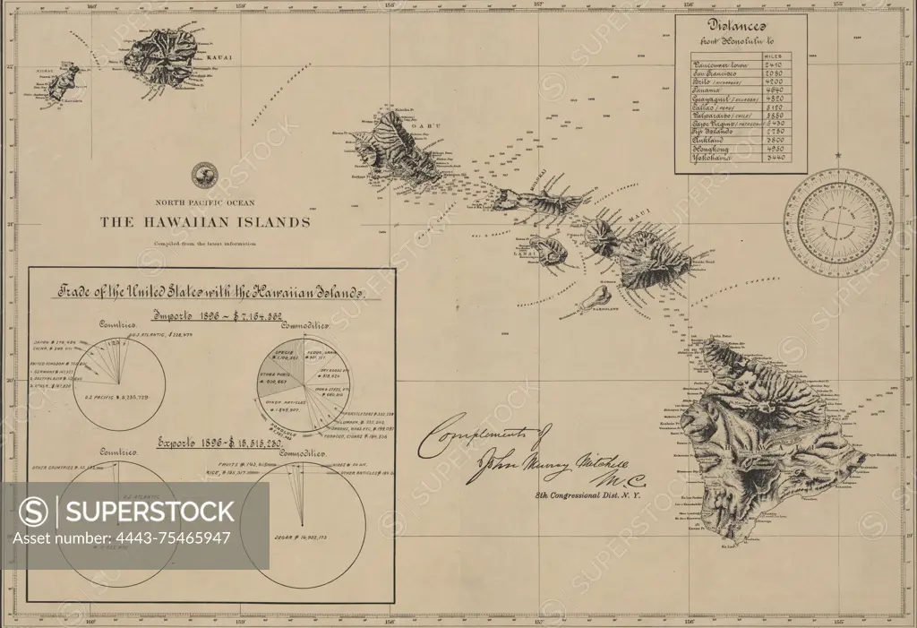
A map titled 'The Hawaiian Islands,' compiled from the latest information in 1896. The map measures 37 x 54 cm, with the sheet size being 42 x 59 cm. It was published by the Hydrographic Office of the U.S. Navy in Washington, D.C. Two copies are noted, each with accession numbers stamped in the lower left corner 64920 and 64921. The second copy lacks a congressional note but includes the signature of the chief of the Treasury Department and the phrase 'Bureau of the American Republics' along the lower margin
SuperStock offers millions of photos, videos, and stock assets to creatives around the world. This image of A map titled 'The Hawaiian Islands,' compiled from the latest information in 1896. The map measures 37 x 54 cm, with the sheet size being 42 x 59 cm. It was published by the Hydrographic Office of the U.S. Navy in Washington, D.C. Two copies are noted, each with accession numbers stamped in the lower left corner 64920 and 64921. The second copy lacks a congressional note but includes the signature of the chief of the Treasury Department and the phrase 'Bureau of the American Republics' along the lower margin by Artokoloro is available for licensing today.
Looking for a license?
Click here, and we'll help you find it! Questions? Just ask!
Click here, and we'll help you find it! Questions? Just ask!
DETAILS
Image Number: 4443-75465947Rights ManagedCredit Line:Artokoloro/SuperStockCollection:Artokoloro Model Release:NoProperty Release:NoResolution:5700×3903