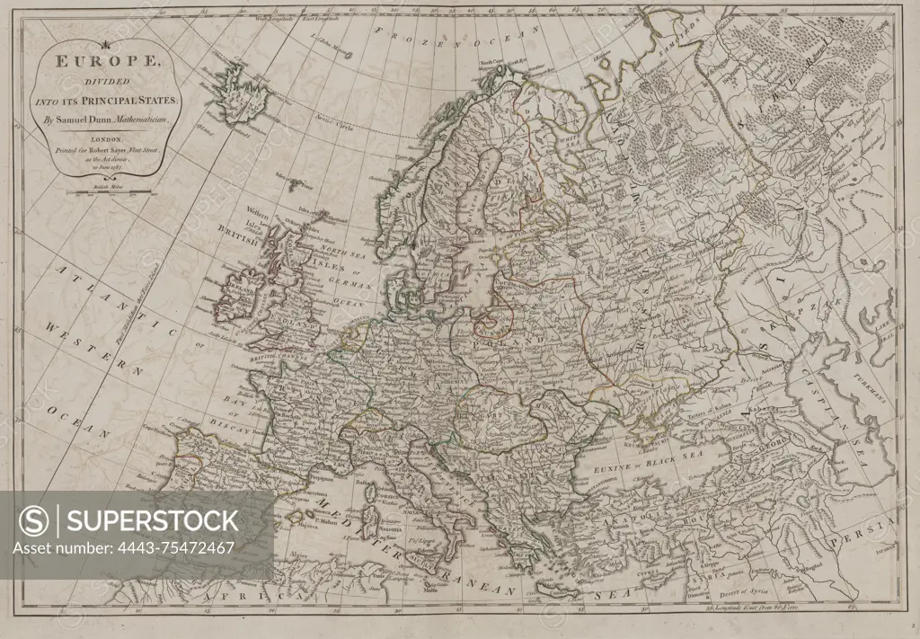
A map titled 'Europe divided into its principal states,' created by Robert Sayer and published in London in 1788. This is the second edition, which includes additions, corrections, and significant improvements. The map reflects geographic divisions of Europe during the late 18th century and is categorized under early British atlases and geographical works. The date of creation is noted as 1787
SuperStock offers millions of photos, videos, and stock assets to creatives around the world. This image of A map titled 'Europe divided into its principal states,' created by Robert Sayer and published in London in 1788. This is the second edition, which includes additions, corrections, and significant improvements. The map reflects geographic divisions of Europe during the late 18th century and is categorized under early British atlases and geographical works. The date of creation is noted as 1787 by Artokoloro is available for licensing today.
Looking for a license?
Click here, and we'll help you find it! Questions? Just ask!
Click here, and we'll help you find it! Questions? Just ask!
DETAILS
Image Number: 4443-75472467Rights ManagedCredit Line:Artokoloro/SuperStockCollection:Artokoloro Model Release:NoProperty Release:NoResolution:6489×4506