A map titled 'A draught of New York from the hook to New York Town,' created in 1737 by W. Mount and T. Page. Issued in London and published by W. Mount & T. Page, the map depicts the New York Harbor and surrounding regions. It measures 46 x 57 cm
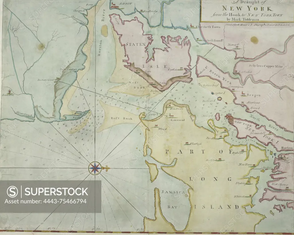
SuperStock offers millions of photos, videos, and stock assets to creatives around the world. This image of A map titled 'A draught of New York from the hook to New York Town,' created in 1737 by W. Mount and T. Page. Issued in London and published by W. Mount & T. Page, the map depicts the New York Harbor and surrounding regions. It measures 46 x 57 cm by Artokoloro is available for licensing today.
Looking for a license?
Click here, and we'll help you find it! Questions? Just ask!
Click here, and we'll help you find it! Questions? Just ask!
DETAILS
Image Number: 4443-75466794Rights ManagedCredit Line:Artokoloro/SuperStockCollection:Artokoloro Model Release:NoProperty Release:NoResolution:4506×3617