Map titled 'De cust van Barbaria, Gualata, Arguyn, en Geneheo, van Capo Verde' from 1672, published by P. Goos in Amsterdam. The map depicts the Atlantic Ocean, including regions such as Cape Verde, Morocco, the Canary Islands, and Western Sahara
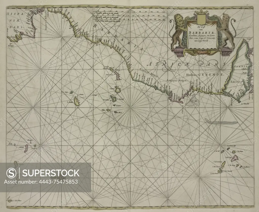
SuperStock offers millions of photos, videos, and stock assets to creatives around the world. This image of Map titled 'De cust van Barbaria, Gualata, Arguyn, en Geneheo, van Capo Verde' from 1672, published by P. Goos in Amsterdam. The map depicts the Atlantic Ocean, including regions such as Cape Verde, Morocco, the Canary Islands, and Western Sahara by Artokoloro is available for licensing today.
Looking for a license?
Click here, and we'll help you find it! Questions? Just ask!
Click here, and we'll help you find it! Questions? Just ask!
DETAILS
Image Number: 4443-75475853Rights ManagedCredit Line:Artokoloro/SuperStockCollection:Artokoloro Model Release:NoProperty Release:NoResolution:5141×4211