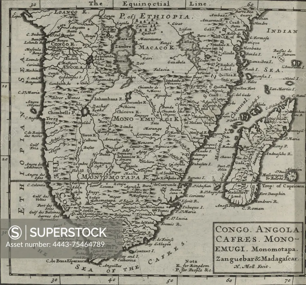
A map titled 'Congo. Angola. Cafres. Monoemugi. Monomotapa. Zanguebar & Madagascar.' published in 1701 by Timothy Childe, located in London. The map showcases various regions in Africa, detailing geographical features and locations
SuperStock offers millions of photos, videos, and stock assets to creatives around the world. This image of A map titled 'Congo. Angola. Cafres. Monoemugi. Monomotapa. Zanguebar & Madagascar.' published in 1701 by Timothy Childe, located in London. The map showcases various regions in Africa, detailing geographical features and locations by Artokoloro is available for licensing today.
Looking for a license?
Click here, and we'll help you find it! Questions? Just ask!
Click here, and we'll help you find it! Questions? Just ask!
DETAILS
Image Number: 4443-75464789Rights ManagedCredit Line:Artokoloro/SuperStockCollection:Artokoloro Model Release:NoProperty Release:NoResolution:3415×3184