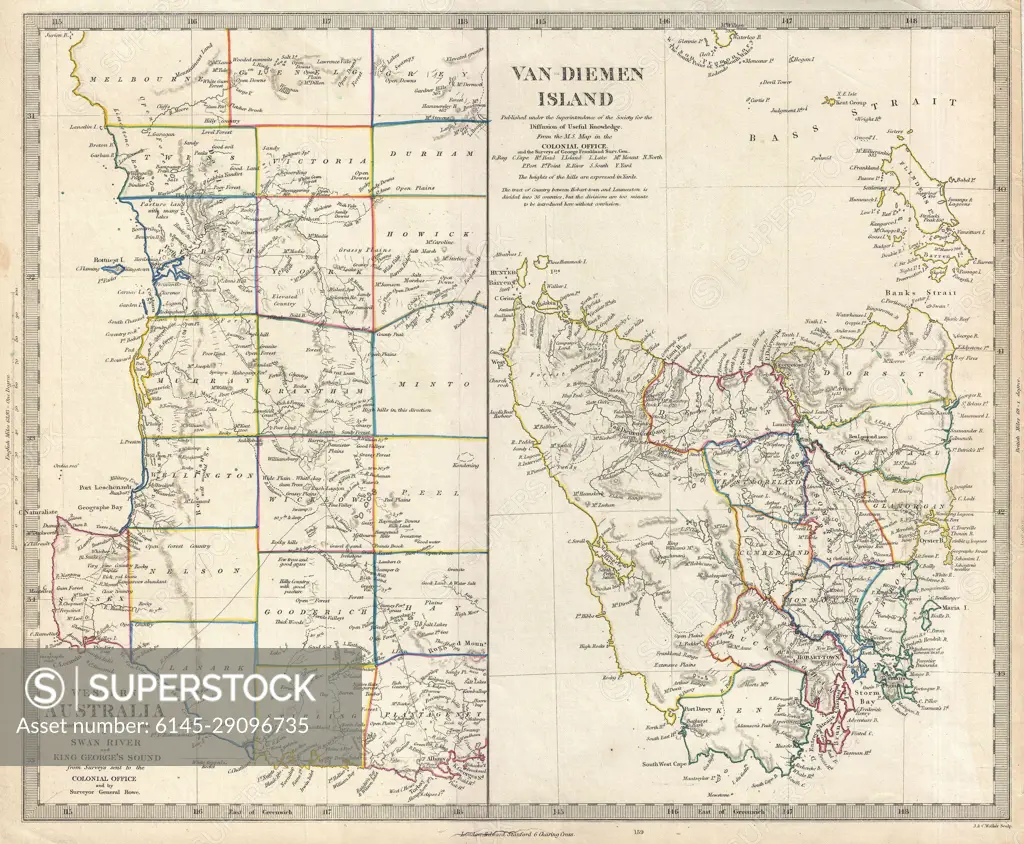
1849 S.D.U.K. Map of Tasmania or Van Diemen's Land and Western Australia
SuperStock offers millions of photos, videos, and stock assets to creatives around the world. This image of Explore Historic Cartography: 19th Century Map of Van Diemen's Island and Western Australia by Piemags/PL Photography Limited is available for licensing today.
DETAILS
Image Number: 6145-29096735Royalty FreeCredit Line:Piemags/PL Photography Limited/SuperStockCollection: