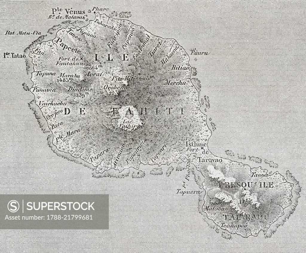
Map of Tahiti Island, French Polynesia, drawing from by The Archipelago of Tahiti, Memories of Pacific, 1872-1874, by A Pailhes, from Il Giro del mondo (World Tour), Journal of geography, travel and costumes, Volume IV, Issue 13, August 24, 1876.
SuperStock offers millions of photos, videos, and stock assets to creatives around the world. This image of Map of Tahiti Island, French Polynesia, drawing from by The Archipelago of Tahiti, Memories of Pacific, 1872-1874, by A Pailhes, from Il Giro del mondo (World Tour), Journal of geography, travel and costumes, Volume IV, Issue 13, August 24, 1876. by DeAgostini is available for licensing today.
Looking for a license?
Click here, and we'll help you find it! Questions? Just ask!
Click here, and we'll help you find it! Questions? Just ask!
DETAILS
Image Number: 1788-21799681Rights ManagedCredit Line:DeAgostini/SuperStockCollection:DeAgostini Model Release:NoProperty Release:NoResolution:4617×3824