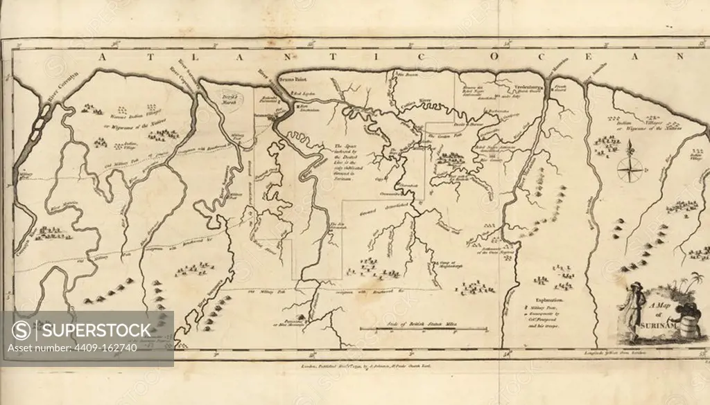
A Map of Surinam, showing Dutch settlements, military posts, rebel Maroon camps and native villages. Copperplate engraving by T. Conder after an original illustration by Captain John Gabriel Stedman from his "Narrative of a Five Years' Expedition against the Revolted Negroes of Surinam," J. Johnson, London, 1813.
This asset has restrictions and cannot be purchased online. Get in touch for more details.
SuperStock offers millions of photos, videos, and stock assets to creatives around the world. This image of Explore Early American History: Antique Map Highlighting 18th Century Colonial Terrain and Atlantic Ocean by Album/Florilegius/Album Archivo is available for licensing today.
Looking for a license?
Click here, and we'll help you find it! Questions? Just ask!
Click here, and we'll help you find it! Questions? Just ask!
DETAILS
Image Number: 4409-162740Rights ManagedCredit Line:Album/Florilegius/Album Archivo/SuperStockCollection:Album Archivo Contributor:Album / Florilegius Model Release:NoProperty Release:NoResolution:6776×3876