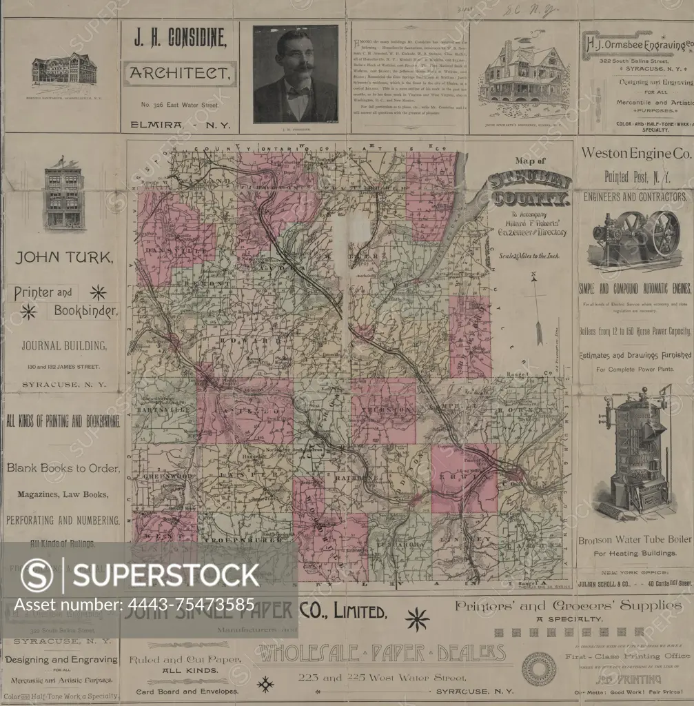
Map of Steuben County, created to accompany Millard F. Roberts' Gazetteer and Directory, published in 1891 by M.F. Roberts in Syracuse, N.Y. The map features details such as railroads, roads, and postal service information within Steuben County, New York. It is colored and measures 45 x 44 cm on a sheet that is 72 x 70 cm
SuperStock offers millions of photos, videos, and stock assets to creatives around the world. This image of Map of Steuben County, created to accompany Millard F. Roberts' Gazetteer and Directory, published in 1891 by M.F. Roberts in Syracuse, N.Y. The map features details such as railroads, roads, and postal service information within Steuben County, New York. It is colored and measures 45 x 44 cm on a sheet that is 72 x 70 cm by Artokoloro is available for licensing today.
Looking for a license?
Click here, and we'll help you find it! Questions? Just ask!
Click here, and we'll help you find it! Questions? Just ask!
DETAILS
Image Number: 4443-75473585Rights ManagedCredit Line:Artokoloro/SuperStockCollection:Artokoloro Model Release:NoProperty Release:NoResolution:5610×5700