Map of the states of North Carolina, South Carolina, and Georgia, 1843, by S. Augustus Mitchell. Additional titles include 'Mitchell's Map of the Carolina's & Georgia' and 'Map of the Carolinas and Georgia.', 1843., Philadelphia. Publisher, S. Augustus Mitchell. The map features steamboat lines, Atlantic Coast (South Atlantic States), and coaching (transportation). It encompasses the Southern States, including North Carolina, South Carolina, and Georgia., 1 hand-colored map measuring 42 x 53 cm, on a sheet of 45 x 57 cm, folded in a cover measuring 14 x 8 cm
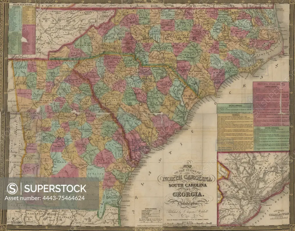
SuperStock offers millions of photos, videos, and stock assets to creatives around the world. This image of Map of the states of North Carolina, South Carolina, and Georgia, 1843, by S. Augustus Mitchell. Additional titles include 'Mitchell's Map of the Carolina's & Georgia' and 'Map of the Carolinas and Georgia.', 1843., Philadelphia. Publisher, S. Augustus Mitchell. The map features steamboat lines, Atlantic Coast (South Atlantic States), and coaching (transportation). It encompasses the Southern States, including North Carolina, South Carolina, and Georgia., 1 hand-colored map measuring 42 x 53 cm, on a sheet of 45 x 57 cm, folded in a cover measuring 14 x 8 cm by Artokoloro is available for licensing today.
Looking for a license?
Click here, and we'll help you find it! Questions? Just ask!
Click here, and we'll help you find it! Questions? Just ask!
DETAILS
Image Number: 4443-75464624Rights ManagedCredit Line:Artokoloro/SuperStockCollection:Artokoloro Model Release:NoProperty Release:NoResolution:5700×4458