Map of the state of New York, issued in 1850 by John Disturnell. The map features the boundaries of counties and townships, as well as the locations of cities, towns, and villages. It illustrates the courses of railroads, canals, and stage roads. The map is hand-colored and measures 46 x 60 cm
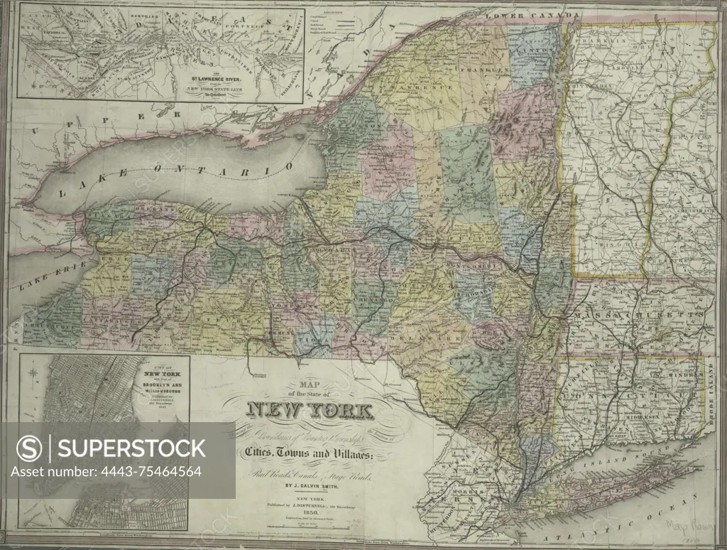
SuperStock offers millions of photos, videos, and stock assets to creatives around the world. This image of Map of the state of New York, issued in 1850 by John Disturnell. The map features the boundaries of counties and townships, as well as the locations of cities, towns, and villages. It illustrates the courses of railroads, canals, and stage roads. The map is hand-colored and measures 46 x 60 cm by Artokoloro is available for licensing today.
Looking for a license?
Click here, and we'll help you find it! Questions? Just ask!
Click here, and we'll help you find it! Questions? Just ask!
DETAILS
Image Number: 4443-75464564Rights ManagedCredit Line:Artokoloro/SuperStockCollection:Artokoloro Model Release:NoProperty Release:NoResolution:4491×3396