Map of the State of New York, issued in 1854 by Charles Magnus. The map, measuring 45 x 56 cm on a sheet of 49 x 60 cm, includes details of railroads and canals in the state, as well as administrative and political divisions. It was published in New York at 12 Frankfort Street
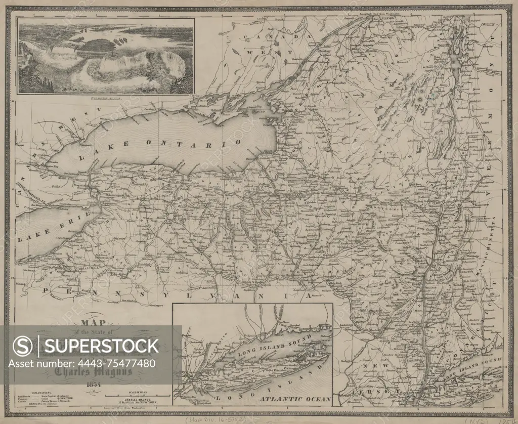
SuperStock offers millions of photos, videos, and stock assets to creatives around the world. This image of Map of the State of New York, issued in 1854 by Charles Magnus. The map, measuring 45 x 56 cm on a sheet of 49 x 60 cm, includes details of railroads and canals in the state, as well as administrative and political divisions. It was published in New York at 12 Frankfort Street by Artokoloro is available for licensing today.
Looking for a license?
Click here, and we'll help you find it! Questions? Just ask!
Click here, and we'll help you find it! Questions? Just ask!
DETAILS
Image Number: 4443-75477480Rights ManagedCredit Line:Artokoloro/SuperStockCollection:Artokoloro Model Release:NoProperty Release:NoResolution:5700×4670