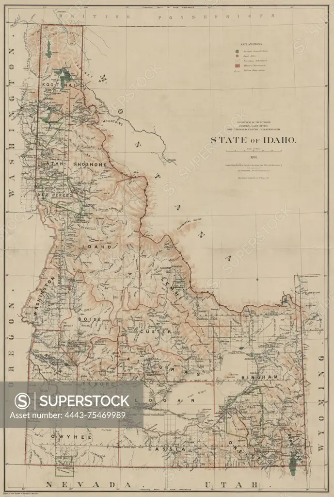
Map of the State of Idaho, issued in 1891 by the General Land Office. The map is in color and measures 100 x 67 cm, with a sheet size of 106 x 73 cm. It includes details related to the geography, Indians of North America, Indian reservations, and administrative and political divisions of Idaho. The lower left corner of the NYPL Map Division copy has accession number 55711 stamped
SuperStock offers millions of photos, videos, and stock assets to creatives around the world. This image of Map of the State of Idaho, issued in 1891 by the General Land Office. The map is in color and measures 100 x 67 cm, with a sheet size of 106 x 73 cm. It includes details related to the geography, Indians of North America, Indian reservations, and administrative and political divisions of Idaho. The lower left corner of the NYPL Map Division copy has accession number 55711 stamped by Artokoloro is available for licensing today.
Looking for a license?
Click here, and we'll help you find it! Questions? Just ask!
Click here, and we'll help you find it! Questions? Just ask!
DETAILS
Image Number: 4443-75469989Rights ManagedCredit Line:Artokoloro/SuperStockCollection:Artokoloro Model Release:NoProperty Release:NoResolution:3836×5700