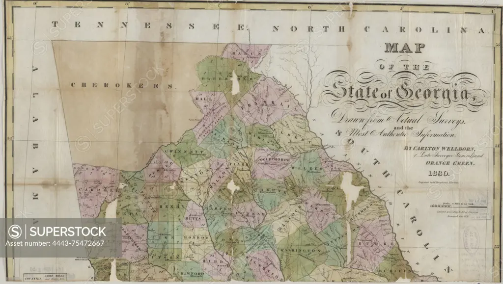
Map of the state of Georgia, drawn from actual surveys and authentic information, issued in 1830. The map, measuring 79 x 69 cm and hand-colored, is divided into two sheets of 40 x 70 cm or smaller, encased in mylar with the original cover. It is designed to be folded to 14 x 10 cm. The place of publication is Savannah, Georgia, though the publisher is not identified. The map depicts the administrative and political divisions of Georgia
SuperStock offers millions of photos, videos, and stock assets to creatives around the world. This image of Map of the state of Georgia, drawn from actual surveys and authentic information, issued in 1830. The map, measuring 79 x 69 cm and hand-colored, is divided into two sheets of 40 x 70 cm or smaller, encased in mylar with the original cover. It is designed to be folded to 14 x 10 cm. The place of publication is Savannah, Georgia, though the publisher is not identified. The map depicts the administrative and political divisions of Georgia by Artokoloro is available for licensing today.
Looking for a license?
Click here, and we'll help you find it! Questions? Just ask!
Click here, and we'll help you find it! Questions? Just ask!
DETAILS
Image Number: 4443-75472667Rights ManagedCredit Line:Artokoloro/SuperStockCollection:Artokoloro Model Release:NoProperty Release:NoResolution:5700×3223