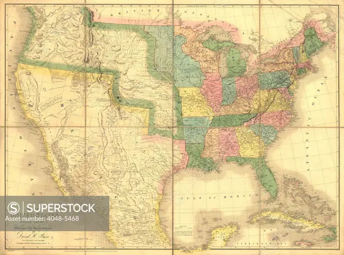
1839 map showing US-Mexican boundary before the Mexican War and US annexation of land that is now US states of California, Arizona, New Mexico, Nevada, Colorado, Utah and Texas.
SuperStock offers millions of photos, videos, and stock assets to creatives around the world. This image of 1839 map showing US-Mexican boundary before the Mexican War and US annexation of land that is now US states of California, Arizona, New Mexico, Nevada, Colorado, Utah and Texas. by Everett Collection is available for licensing today.
DETAILS
Image Number: 4048-5468Rights ManagedCredit Line:Everett Collection/SuperStockCollection:Everett Collection Model Release:NoProperty Release:NoResolution:2550×1891
